Dec 28, 2020
USDA research seeks prediction, prevention of soil erosion
“Dirt cheap” – it’s an old saying, but hardly accurate. The fact is, the United States loses about $44 billion each year from soil erosion. The challenge is to keep that dirt where it is needed.
Soil erosion is the detachment and movement of soil from one place to another by water or wind. Agricultural Research Service (ARS) scientists from around the country have long studied the problem and recently developed a coordinated strategic vision for ongoing ARS erosion research, including improved models to predict erosion and how to control it. Their work, the ARS Strategic Plan for Erosion, was published in the November/December issue of the Journal of Soil and Water Conservation.
“ARS is the world leader in understanding and modeling erosion and has been since at least the 60’s,” said Marlen Eve, ARS deputy administrator for natural resources and sustainable agricultural systems. “Erosion mitigation research has been a core effort of ARS for decades and this strategic plan is an effort to modernize our models and create new ‘precision agriculture’ approaches to managing soils and mitigating erosion. This is a doubling down on our commitment. Our soil erosion research is helping lead America toward a more sustainable, food secure future.”
The plan is the result of an ARS soil erosion modeling workshop held in the fall of 2019 and is a coordinated effort across several soil erosion modeling platforms, including the Rangeland Hydrology Erosion Model (RHEM). RHEM has been a focus of several ARS labs for nearly 30 years. In addition, the U.S. Department of the Interior’s Bureau of Land Management (BLM) and USDA’s Natural Resources Conservation Service (NRCS) rely on RHEM.
The ARS team has also developed an RHEM PowerPoint tutorial for NRCS, BLM, and the governments of Kazakhstan and Jordan and provides training upon request to state and federal agencies.
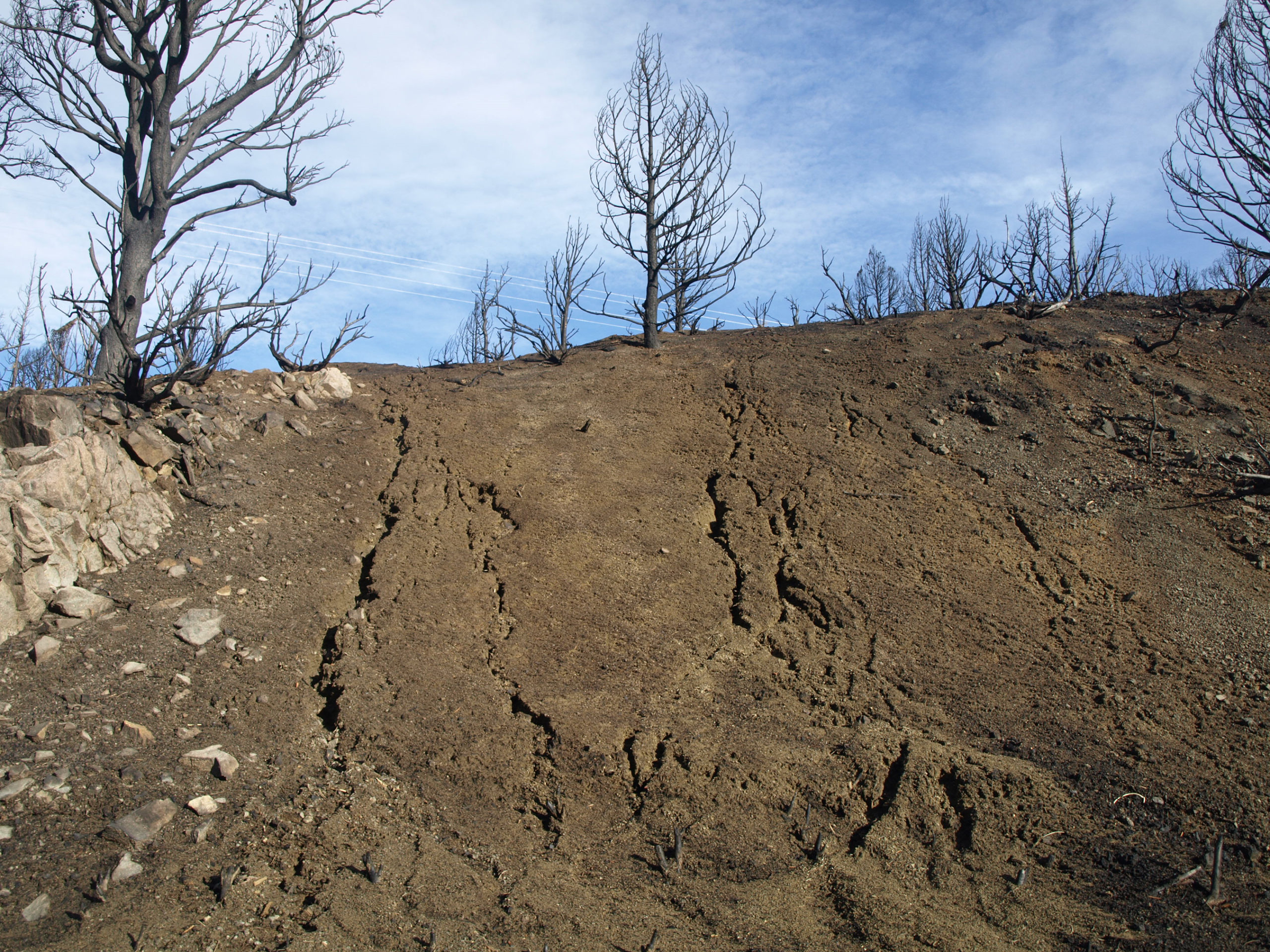
“The most vulnerable rangeland areas for soil movement are where annual precipitation is between 4 and 16 inches per year, which limits the soil moisture available to sustain plant growth,” said Mark Weltz, rangeland hydrologist with the ARS Great Basin Rangelands Research Unit in Reno, NV. Weltz was one of the authors of the ARS Strategic Plan for Erosion. With low plant density and minimal plant canopy and ground cover, these arid and semi-arid areas are prone to erosion from wind and water following wildfires, or from overgrazing and off-road vehicles.
Typical consequences of erosion include reduced soil quality for plant growth; build-up of eroded sediment in riverbeds, harbors, and behind dams that must be removed to maintain safe passage and prevent dam over-topping; and transportation of salts and nutrients that reduce water quality, such as algae blooms that harm aquatic life. To get a picture of what extreme wind and water erosion can lead to, one has only to look at historical records of the Great Dust Bowl of the 1930s and national monuments, such as the Grand Canyon and the Badlands.
“The subtle aspect to soil erosion is that it removes water-holding capacity that plants need to grow and restricts the types of plants that can grow on the site,” Weltz said. “Further, most plant nutrients are stored in the surface soil. Once lost, it may take centuries to recover. In certain situations, once soil erosion has occurred to sufficient depth the productivity of the site is forever lost.”
Fortunately, there are things that can be done to mitigate or prevent erosion, and that’s where the ARS Strategic Plan for Soil Erosion comes in.
Above, an example of rangeland soil erosion. Photo: Mark Weltz/USDA ARS


